Randonnée Marche Ponts sur Seulles - lantheuil 10 kms 2017 - Photo
 aubinjoel
aubinjoel

Utilisateur

© OpenStreetMap contributors
Longueur
Longueur
8,9 km
Altitude max
Altitude max
46 m
Dénivelé positif
Dénivelé positif
103 m
Km-Effort
Km-Effort  
10,3 km
Altitude min
Altitude min
5 m
Dénivelé négatif
Dénivelé négatif
104 m
Boucle
Boucle
Oui
Date de création :
2017-07-10 00:00:00.0
Dernière modification :
2017-07-10 00:00:00.0

(1 Avis)

Marche
Marche
--
Difficulté : Facile

Scannez ce code QR pour ouvrir la randonnée dans l'application SityTrail

Application GPS de randonnée GRATUITE

Logo SityTrail SityTrail

IGN / Instituts géographiques

Télécharger SityTrail sur l'App Store Télécharger SityTrail sur Google Play

Logo SityTrail SityTrail World

Le monde est à vous

Télécharger SityTrail sur l'App Store Télécharger SityTrail sur Google Play Télécharger SityTrail sur Huawei AppGallery

À propos

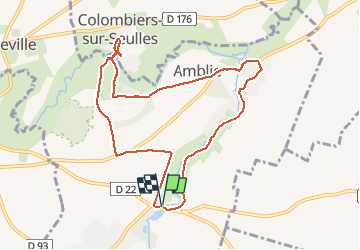
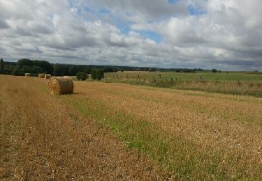
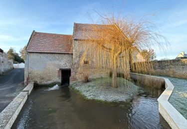
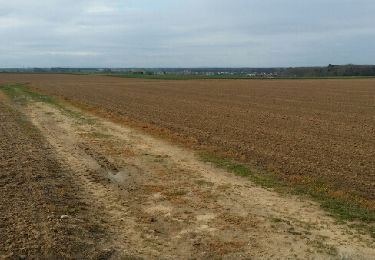
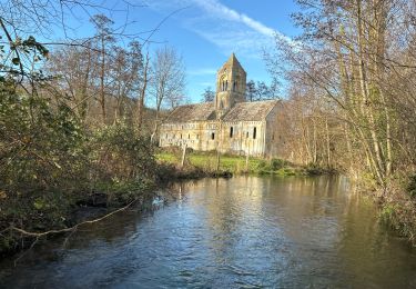
Randonnée Marche de 8,9 km à découvrir à Normandie, Calvados, Ponts sur Seulles. Cette randonnée est proposée par aubinjoel.

Profil altimétrique

Points d'intérêt

Point d'intérêt Ponts sur Seulles - 1 - Photo
aubinjoel
PONTS SUR SEULLES 
Point d'intérêt Ponts sur Seulles - 2 - Photo
aubinjoel
PONTS SUR SEULLES 
Point d'intérêt Ponts sur Seulles - 3 - Photo
aubinjoel
PONTS SUR SEULLES 
Point d'intérêt Ponts sur Seulles - 4 - Photo
aubinjoel
PONTS SUR SEULLES 
Point d'intérêt Ponts sur Seulles - 5 - Photo
aubinjoel
PONTS SUR SEULLES 

Localisation

Pays :
France
Région :
Normandie
Département/Province :
Calvados
Commune :
Ponts sur Seulles
Localité :
Lantheuil
Départ:(Dec)
Départ:(UTM)
681552 ; 5461148 (30U) N.

Commentaires

Veuillez vous connecter pour laisser un commentaire ou une note


très content utilisateur depuis 2 ans


Randonnées à proximité

Randonnée A pied Le Fresne-Camilly - autours de Fresne-Camilly, Fontaine Henry - Photo
A pied
Privatb

A pied

Moyen
(1)
Le Fresne-Camilly, Normandie, Calvados, France
18,8 km | 21 km-effort
4h 50min
Oui
Randonnée Marche Fontaine-Henry - Fontaine-Henry-Claude - Photo
Marche
gr1346

Marche

Facile
(1)
Fontaine-Henry, Normandie, Calvados, France
7,8 km | 9,1 km-effort
2h 1min
Oui
Randonnée V.T.T. Creully sur Seulles - creuilly- asnelles - Photo
V.T.T.
mouss65

V.T.T.

Moyen
Creully sur Seulles, Normandie, Calvados, France
44 km | 49 km-effort
2h 42min
Oui
Randonnée sport Cairon - Départ Cairon  - Photo
sport
papylou7

sport

Très facile
Cairon, Normandie, Calvados, France
14,1 km | 15,9 km-effort
Inconnu
Oui
Randonnée V.T.T. Fontaine-Henry - reco vtt photo CTDCCR2016 - Photo
V.T.T.
mouss65

V.T.T.

Facile
Fontaine-Henry, Normandie, Calvados, France
14,1 km | 16,1 km-effort
1h 9min
Non
Randonnée A pied Fontaine-Henry - j 3 fontai henry   - Photo
A pied
chrisdouville

A pied

Facile
Fontaine-Henry, Normandie, Calvados, France
8,9 km | 10,6 km-effort
2h 24min
Oui
Randonnée Marche Cairon - cairon annick - Photo
Marche
gr1346

Marche

Moyen
Cairon, Normandie, Calvados, France
7,6 km | 8,2 km-effort
2h 5min
Oui
Randonnée Marche Thaon - Thaon - Photo
Marche
papylou7

Marche

Facile
Thaon, Normandie, Calvados, France
17,9 km | 19,9 km-effort
3h 46min
Oui
Randonnée V.T.T. Cairon - Cairon-la mer  - Photo
V.T.T.
memeche

V.T.T.

Très difficile
Cairon, Normandie, Calvados, France
46 km | 50 km-effort
4h 24min
Oui


Fermer
Mes abonnements